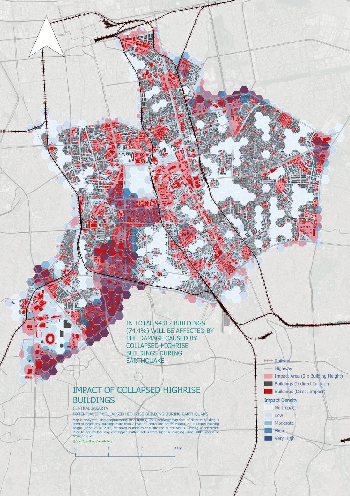
Quick Assessment of Collapsed High-Rise Building Impacts During an Earthquake in Central Jakarta May 3, 2025 No Comments Read More »
Participatory Mapping for Supporting Disaster Response Mount Lewotobi Eruption 2024 March 14, 2025 No Comments Read More »
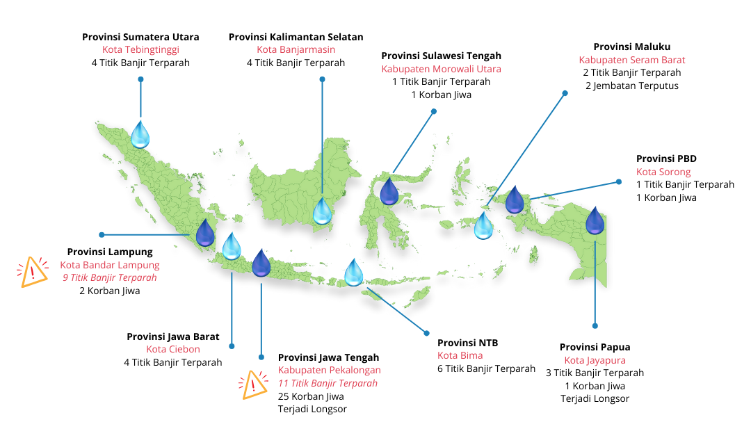
Assessing Flood and Landslide Exposure using OpenStreetMap Data March 14, 2025 No Comments Read More »
Introducing Maps and OpenStreetMap to the Youth of the Bogor City Scout Movement October 3, 2024 No Comments Read More »
Involvement of Scout Community in Disaster Preparedness through Open Mapping and OpenStreetMap Utilization September 25, 2023 No Comments Read More »
Project MURIA: Empowering Youth Communities for Urban Resilience and Livelihood Enhancement September 15, 2023 No Comments Read More »
Quick Assessment of Collapsed High-Rise Building Impacts During an Earthquake in Central Jakarta May 3, 2025 No Comments Read More »
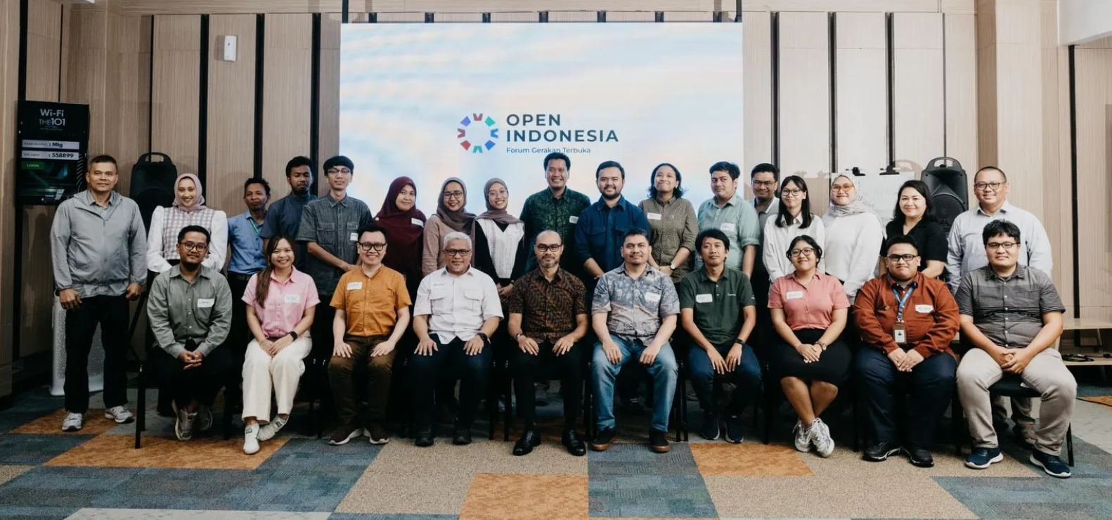
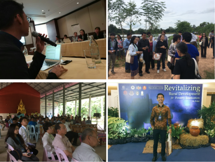
Community-Driven Innovations for Sustainable Urban Development in UNDP Accelerator Day 2025 March 4, 2025 No Comments Read More »
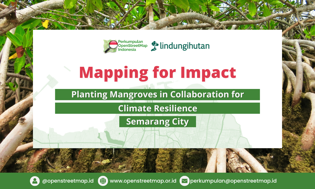
Mapping for Impact: A Participatory Mangrove Planting Campaign for Climate Resilience and Flood Mitigation in Semarang February 25, 2025 No Comments Read More »
SiPetani DKI: Empowering Agriculture in Jakarta Through Digital Innovation September 22, 2023 No Comments Read More »
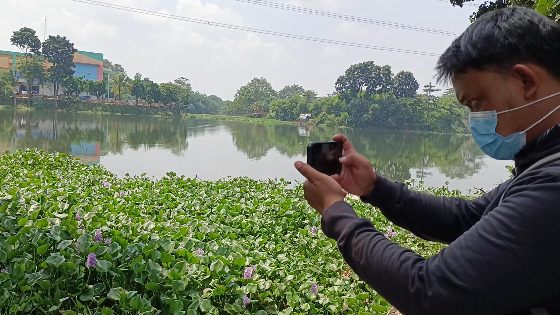
Engaging the Crowd: Mapping Lakes in Jabodetabek-Punjur for Flood Mitigation July 14, 2023 No Comments Read More »
Booster Grant: A Program to Increase the Utilization of OpenStreetMap Data by Local Communities in Indonesia July 4, 2023 No Comments Read More »
Measuring Bikeability in Central Jakarta using OpenStreetMap Data October 6, 2024 No Comments Read More »
Estimating Travel Time for the KRL Route from Bogor to Jakarta Kota Using OpenStreetMap Data October 3, 2024 No Comments Read More »
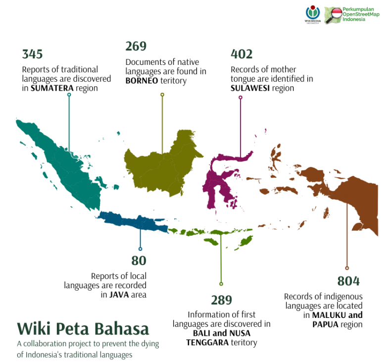
Wiki Peta Bahasa: Unveiling Indonesia Traditional Languages Diversity through Ushahidi as an Open Web Maps August 14, 2023 No Comments Read More »
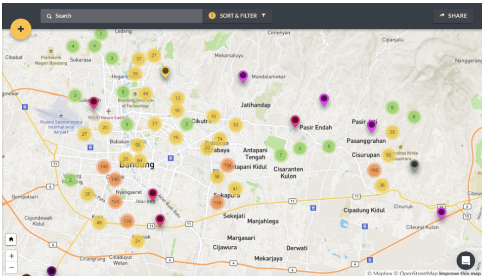
Enhancing Youth Participation in the Development of Bandung City through Ushahidi Platform August 9, 2023 No Comments Read More »
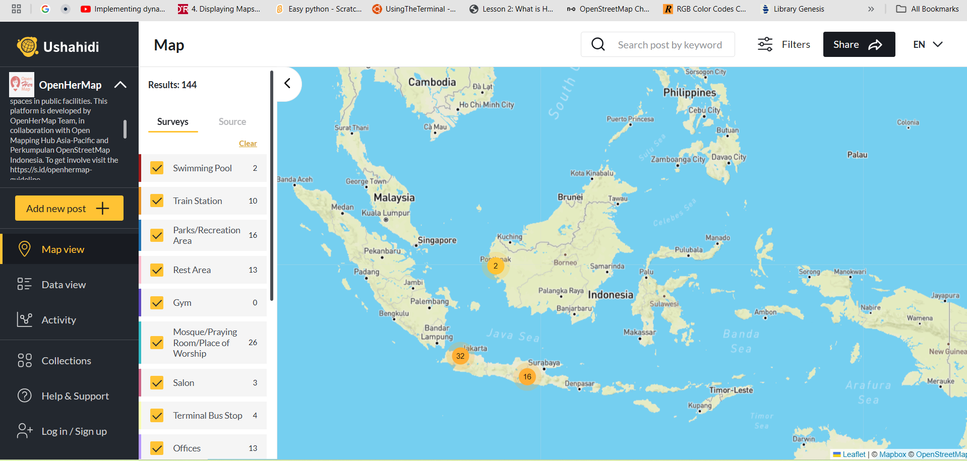
Crowdsource Mapping for Women Facility in Indonesia and Srilanka “OpenHerMap” February 19, 2025 No Comments Read More »
Booster Grant: A Program to Increase the Utilization of OpenStreetMap Data by Local Communities in Indonesia July 4, 2023 No Comments Read More »
Program Booster Grant 2022 untuk Meningkatkan Pemanfaatan Data OpenStreetMap oleh Komunitas Lokal di Indonesia June 23, 2023 No Comments Read More »
OpenStreetMap untuk Pembangunan Desa dan Pengentasan Kemiskinan August 7, 2017 No Comments Read More »
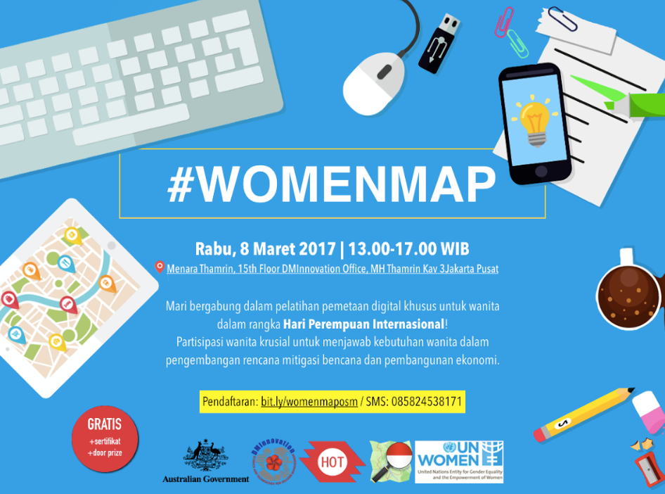
Pelatihan Pemetaan Digital untuk Perayaan Hari Perempuan Sedunia March 13, 2017 No Comments Read More »
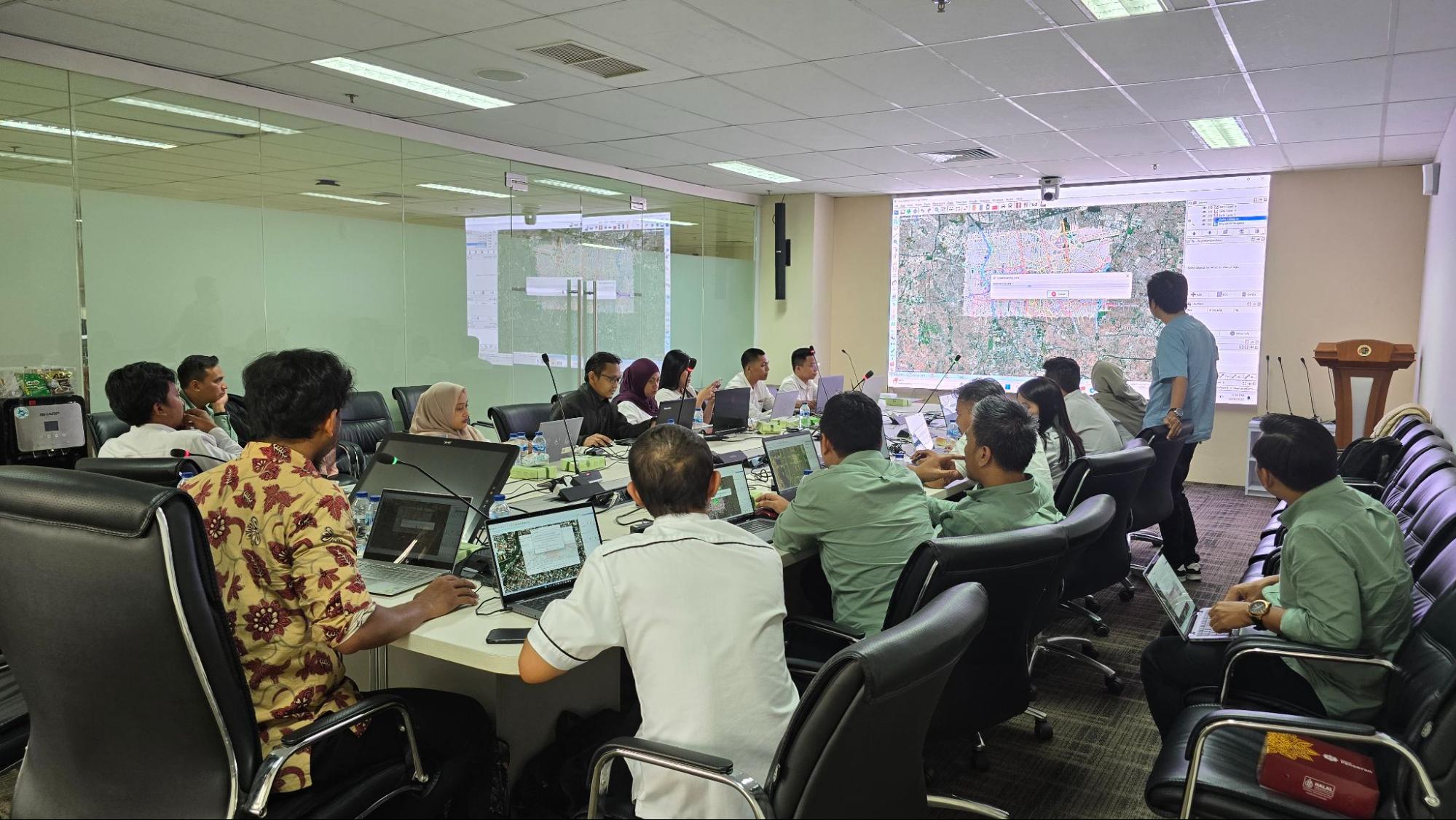
Open Mapping for Public Good: The Role of OpenStreetMap in Government Services, BPN Training May 5, 2025 No Comments Read More »
Komunitas OSM Lokal dan HOT-Meta Berkolaborasi Meningkatkan Cakupan Peta Jaringan Jalan di Indonesia April 4, 2018 No Comments Read More »
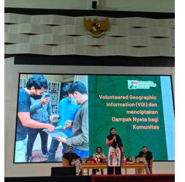
Involving the Youth Community in the Volunteered Geographic Information (VGI) October 29, 2025 No Comments Read More »
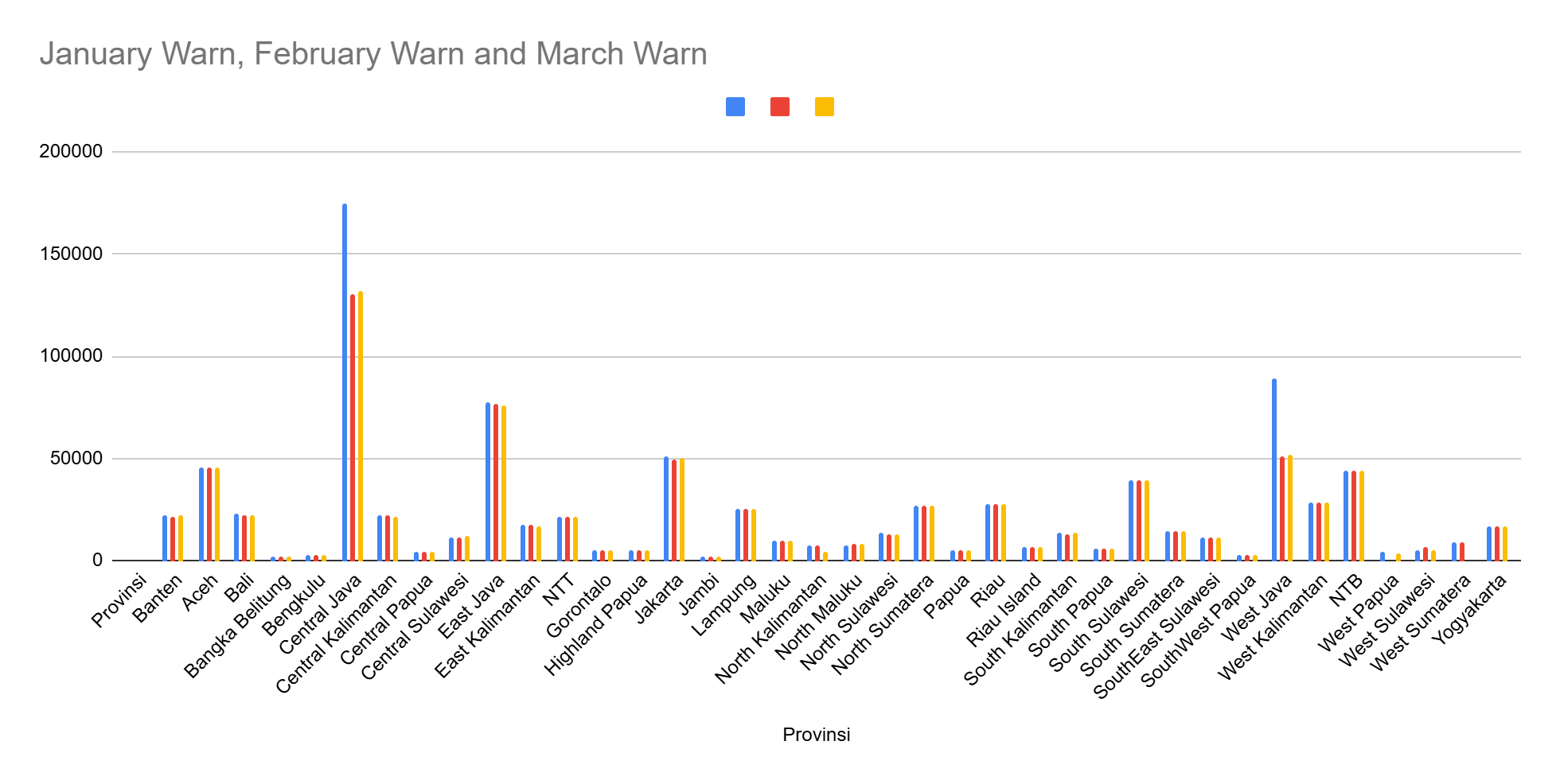
Mapping Quality in Motion: Assessing OpenStreetMap Data in Indonesia (Q1 2025) May 25, 2025 No Comments Read More »
Open Mapping for Public Good: The Role of OpenStreetMap in Government Services, BPN Training May 5, 2025 No Comments Read More »
Introducing Maps and OpenStreetMap to the Youth of the Bogor City Scout Movement October 3, 2024 No Comments Read More »