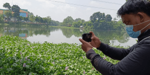
Involvement of Scout Community in Disaster Preparedness through Open Mapping and OpenStreetMap Utilization

The Scout Movement is one of the communities that play a significant role in impacting various humanitarian activities in Indonesia. Besides having an organized network and system, it also has a very large number of members with different levels, some of which are based on the education system levels in Indonesia. Therefore, the involvement of the Scout Movement in various humanitarian activities is systematic and reaches various levels of society. Furthermore, their collaboration with various other humanitarian organizations makes humanitarian activities more comprehensive and targeted.

Community-Driven Handwashing Stations in Response to COVID-19

Indonesia confirmed its first cases of COVID-19 on 2 March 2020, when a dance instructor and her mother tested positive after arriving from Japan. The country encountered significant difficulties in containing the virus due to its large population, high population density in specific regions, and limited healthcare resources in certain areas. Consequently, by 9 April 2020, the pandemic had reached all 34 provinces in Indonesia. As of 5 June 2023, Indonesia has reported 6,812,127 COVID-19 cases, the second highest in Southeast Asia. Regarding fatalities, Indonesia ranks second in Asia and ninth globally, with 161,879 deaths recorded.

Engaging the Crowd: Mapping Lakes in Jabodetabek-Punjur for Flood Mitigation

Floods are a relatively common occurrence in Indonesia due to the country’s geographical location, climate patterns, and natural topography. Indonesia experiences riverine and coastal flooding, varying frequencies depending on the region. Over the years, the densely populated capital and its surrounding cities (Jakarta, Bogor, Depok, Tangerang, Bekasi, Puncak, and Cianjur or Jabodetabek-Punjur) have experienced catastrophic flooding, most recently in 2020.

Booster Grant: A Program to Increase the Utilization of OpenStreetMap Data by Local Communities in Indonesia

There are many things to implement free and open spatial data, such as disaster response mapping to evacuate the victims, road network mapping for transportation systems, and so forth. However, those can only be implemented when spatial data is available. Participatory mapping, as a collaborative map-making process utilizing OpenStreetMap as a freely accessible platform, involves the active involvement of government, scholars, and communities as key stakeholders. This approach is essential for collectively identifying and mapping geographic features, especially in disaster-prone regions, where sharing spatial data has historically posed significant challenges in Indonesia. The goal of participatory mapping is to generate and share openly available spatial data that can be accessed by the public, addressing the need for collective and accessible information in these areas. From the beginning of 2022 until the end of March 2022, Indonesia witnessed over 1000 natural disasters, resulting in approximately 1.5 million individuals affected, as reported by the National Agency for Disaster Management (BNPB) of Indonesia.

Program Booster Grant 2022 untuk Meningkatkan Pemanfaatan Data OpenStreetMap oleh Komunitas Lokal di Indonesia

Banyak hal untuk mengimplementasikan data spasial bebas dan terbuka, seperti pemetaan tanggap bencana untuk memudahkan evakuasi korban, hingga pemetaan jaringan jalan untuk mendukung akses transportasi. Namun, hal tersebut tidak dapat diimplementasikan jika data spasial tidak tersedia. Pemerintah, akademisi, komunitas, dan masyarakat menjadi bagian keseluruhan dari pemetaan partisipatif dengan menggunakan OpenStreetMap sebagai platform pemetaan yang bebas dan terbuka. Pemetaan partisipatif ini sangat penting dilakukan dalam upaya pengumpulan data spasial yang dapat diakses oleh seluruh lapisan masyarakat, terutama di area yang rentan akan bencana alam. Dikutip dari data Badan Nasional Penanggulangan Bencana (BNPB) Indonesia, sejak awal tahun 2022 hingga akhir Maret 2022, telah terjadi lebih dari 1000 bencana alam di Indonesia dengan total 1,5 juta korban. Demi memenuhi kebutuhan data spasial yang lengkap, terbaru dan akurat, terutama di area rentan bencana; organisasi non-profit Perkumpulan OpenStreetMap Indonesia (POI) dan Open Mapping Hub Asia-Pacific (OMHAP), berkolaborasi melalui program Booster Grant. Program ini bertujuan untuk mendukung secara finansial komunitas-komunitas lokal di Indonesia yang sudah dan sedang melakukan aktivitas pemetaan dengan menggunakan data OpenStreetMap. Harapannya, dengan ada dukungan finansial ini dapat membantu meningkatkan jumlah masyarakat yang memahami penggunaan teknologi bebas dan terbuka melalui visibilitas proyek pemetaan, sehingga mendorong lebih banyak orang untuk berpartispasi dalam kegiatan pemetaan untuk dapat menghasilkan data spasial yang akurat.