• About Us
  • Projects
  • Services
    • Capacity Building
    • Open Data Analytic & Innovation
    • Projects Annual Reports
    • Case Studies
    • Modules
  • Get Involved
    • Mapping Volunteers
    • Partner With Us
    • Join Our Community
    • Job Opportunities
  • OSM Analytic & Statistics
LOGO POI (no background) 1

Day: March 14, 2025

Impacted Area using Exposure Data from OSM
Disaster Risk Reduction

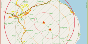
Participatory Mapping for Supporting Disaster Response Mount Lewotobi Eruption 2024

Indonesia is a country prone to natural disasters due to its geographical location. The country’s situated at the intersection of several tectonic plates, and its terrain is characterized by mountain …

Disaster Risk Reduction

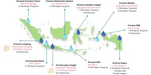
Assessing Flood and Landslide Exposure using OpenStreetMap Data

As 2025 begins, Indonesia is again plagued by floods, a recurring disaster that has become an annual routine. Despite the country’s relatively uniform rainfall distribution, many areas have been hit …

POI is a non-profit organization focused on capacity building, community development, youth initiative, and open mapping innovation & technology.

Feature

  • About Us
  • Our Work
  • Resources
  • POI Dashboard
Facebook Instagram X-twitter Youtube Telegram Linkedin
Office

Plaza Marein Lt.23, Jl. Jenderal Sudirman Kav. 76-78 Jakarta, 12910

Discussion and Collaboration contact us perkumpulan @openstreetmap.id

Subscribe !