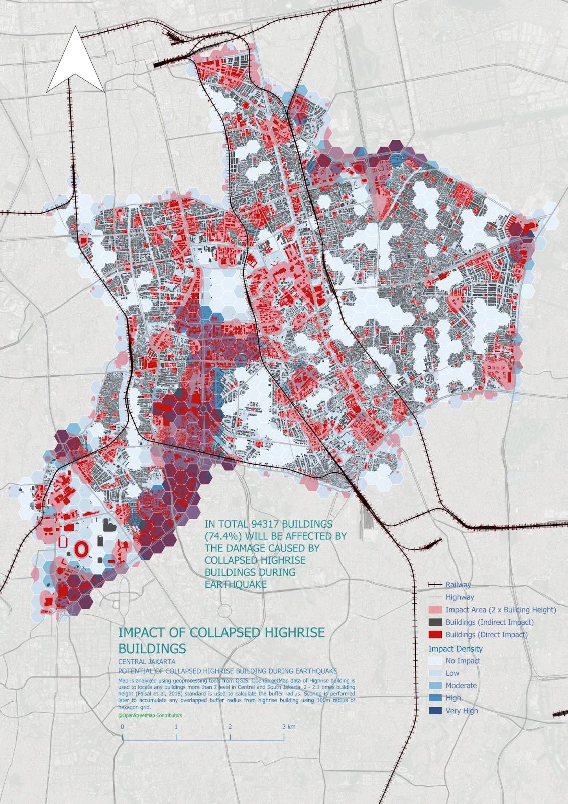
Quick Assessment of Collapsed High-Rise Building Impacts During an Earthquake in Central Jakarta May 3, 2025 No Comments Read More »
Participatory Mapping for Supporting Disaster Response Mount Lewotobi Eruption 2024 March 14, 2025 No Comments Read More »
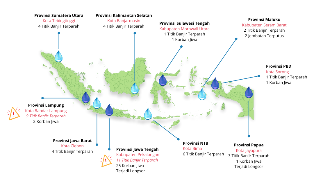
Assessing Flood and Landslide Exposure using OpenStreetMap Data March 14, 2025 No Comments Read More »
Introducing Maps and OpenStreetMap to the Youth of the Bogor City Scout Movement October 3, 2024 No Comments Read More »
Involvement of Scout Community in Disaster Preparedness through Open Mapping and OpenStreetMap Utilization September 25, 2023 No Comments Read More »
Project MURIA: Empowering Youth Communities for Urban Resilience and Livelihood Enhancement September 15, 2023 No Comments Read More »