On April 26, 2025, something long overdue finally happened: the Indonesian OpenStreetMap (OSM) community gathered in person after several years of purely online engagement. This event marked the first offline meetup in years for both individual contributors and members of the Perkumpulan OpenStreetMap Indonesia (POI), reigniting the spirit of collaboration and exchange that had previously thrived in the community.

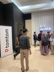
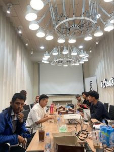
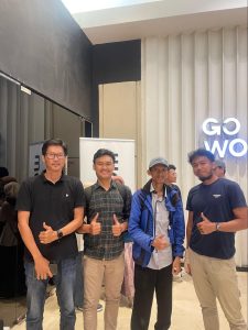
The event, dubbed a “Community Meetup” and informally referred to as a “Mapping Party,” was made possible through the support of TomTom, a global leader in spatial data solutions. Hosted in Jakarta, the meetup was organized with the help of POI and was attended by 12 contributors representing diverse professional and geographical backgrounds. Despite its relatively small scale, the gathering was rich in dialogue, sharing, and collaboration, serving as a stepping stone toward a more vibrant and interconnected open mapping community in Indonesia.
Reconnecting in a Post-Pandemic Landscape
The COVID-19 pandemic, coupled with logistical and organizational challenges, had significantly hindered in-person gatherings for the Indonesian OSM community. While virtual communication tools helped maintain minimal collaboration, they couldn’t replace the sense of camaraderie, spontaneous idea-sharing, and deep engagement that often occurs in physical meetups. This made the April 2025 meetup particularly meaningful—not just as a logistical success, but as a symbolic reconnection of minds and missions.
TomTom’s decision to facilitate the event, including providing a venue and logistical support, was warmly welcomed. It showcased a growing trend of corporate interest in supporting open data communities, especially in regions where grassroots mapping can have a real-world impact on issues like urban planning, disaster response, and sustainable development.
A Hybrid Format for Broader Participation
Although the physical gathering in Jakarta was limited to 12 individuals due to space and planning constraints, the organizers ensured that the broader community could still participate. The meetup featured a hybrid format, where contributors from across Indonesia and beyond could join online.
One of the core activities was a collaborative mapping session using MapRoulette, a micro-tasking platform designed for improving OSM data quality. Before the session, in-person attendees received tutorials and guidelines on how to use the platform. These were later shared with online participants, allowing them to contribute to the mapping efforts in real-time.
This hybrid approach allowed the meetup to reach a much larger audience than those who could be physically present, demonstrating a scalable model for future events that prioritize inclusivity and flexibility.
Stories of Impact: OSM in Action
One of the highlights of the meetup was a series of short presentations and open-floor discussions where attendees shared how they use OSM data in their respective fields. Despite time limitations, the range of applications discussed was impressive and eye-opening.
A few contributors discussed how OSM data had been integrated into gaming platforms to enhance realism and navigation mechanics. Another participant shared a case study on how OSM has been used in asset mapping for local governments, helping improve infrastructure planning and maintenance.
Other presentations included the use of OSM in emergency response systems, particularly during natural disasters where timely and accurate mapping can save lives. There were also insights into how OSM supports academic research, ranging from environmental studies to urban development, and how transportation companies are leveraging open map data to optimize routing and logistics.
These stories not only underscored the versatility and power of OSM data but also highlighted the importance of maintaining and improving data quality through collective effort.
Building a Culture of Sharing
One key message echoed throughout the event was the importance of sharing—not just data, but knowledge, tools, and experiences. POI representatives encouraged participants to be more active in sharing their projects and practices through social media and community platforms. This, they noted, would help elevate the visibility of OSM in Indonesia and inspire new contributors to join the movement.
The organizers emphasized that OSM’s greatest strength lies in its community. By fostering a culture where contributors feel comfortable exchanging insights and asking for help, the Indonesian OSM community can grow not just in size, but in depth and impact. POI also stressed the value of transparency and collaboration between individuals, non-profit organizations, academia, and the private sector. These multi-stakeholder partnerships, they argued, are essential for unlocking the full potential of open mapping initiatives.
A Vision for the Future: Toward Larger Gatherings
While this meetup was relatively small in scale, it planted the seeds for something bigger. Inspired by the energy and enthusiasm of the participants, discussions began around the possibility of organizing a larger community meetup in late 2025 or early 2026.
This envisioned event would aim to bring together a broad cross-section of OSM contributors and open data enthusiasts from across Indonesia. More than just a mapping event, it would be a cross-disciplinary gathering where participants could discuss not only technical aspects of mapping but also intersecting issues in technology, environment, culture, academic research, public health, and governance.
Such a meetup would serve multiple purposes: strengthening networks, showcasing innovations, identifying collaboration opportunities, and building capacity among new and existing mappers. Importantly, it would also help to ensure that the OSM movement in Indonesia remains inclusive, relevant, and future-facing.
The Role of Corporate and Academic Collaboration
A recurring theme during the meetup was the importance of support from institutions—whether corporations like TomTom or Kaart, academic institutions, or government agencies. Events like these are resource-intensive and can place a significant burden on community organizations like POI if done alone.
By collaborating with partners who share an interest in open data and spatial analysis, the OSM community can gain access to more stable funding, better infrastructure, and broader networks of expertise. These partnerships, however, must be built on mutual respect and shared values, with a clear understanding that the community’s independence and ethos must be preserved.
With TomTom’s support in this initial event, there is hope that other stakeholders will step forward to help make the next community meetup a reality. With shared effort, these meetups can become a collective achievement—owned and celebrated by the entire OSM community in Indonesia.
A Stepping Stone, Not a Destination
The April 2025 Community Meetup was not an endpoint, but a new beginning. It reminded everyone of the power of community-driven efforts and the importance of personal connections in sustaining long-term collaboration. It showcased how a small group of dedicated individuals can come together to spark dialogue, exchange ideas, and inspire future action.
More importantly, it laid the groundwork for a more ambitious roadmap: to re-establish regular community meetups, foster new forms of collaboration, and elevate the presence of OSM in Indonesia’s digital and development landscapes.
As Indonesia continues to face complex challenges—from rapid urbanization to climate resilience—the role of accurate, accessible, and open spatial data will only become more critical. The OSM community, with its unique blend of grassroots energy and technical expertise, is well-positioned to be a key player in this future.
With continued support, shared leadership, and a spirit of inclusivity, this “stepping stone” initiative may well lead to a stronger, smarter, and more sustainable open mapping ecosystem for Indonesia and beyond