In recent years, open mapping platforms like OpenStreetMap (OSM) have emerged as critical tools for spatial data management, particularly within the public sector. These tools not only support transparency and collaboration but also offer cost-effective and scalable solutions to geographic data challenges.
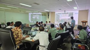
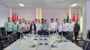
In Indonesia, government interest in open mapping has grown steadily, with a recent and notable example coming from the Jakarta Regional Office of the National Land Agency (Badan Pertanahan Nasional or BPN). In early 2025, the agency formally requested a training session on OpenStreetMap for its internal staff. The training, facilitated by Perkumpulan OpenStreetMap Indonesia (POI), reflects a growing recognition within government circles of the value OSM offers for national development, spatial governance, and public service delivery.
Building Awareness: Introducing OSM to Government Staff
The training session was designed to introduce the basics of OSM to BPN staff. This included a presentation on what OSM is, how it operates, and how the platform has developed over time, from a grassroots digital mapping initiative to a globally recognized spatial data platform used by millions.
OSM was introduced as more than just a digital map—it is a dynamic, community-driven database of geospatial information that is freely accessible and modifiable. Unlike proprietary GIS platforms, OSM offers governments the opportunity to not only use but also contribute to a shared mapping infrastructure. This aligns with the principles of open data, citizen participation, and digital transformation.

The session emphasized the global reach of OSM, citing examples from around the world where it is already being used by governments for urban planning, emergency response, infrastructure monitoring, and more.
Exploring Use Cases: How OSM Can Support BPN
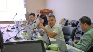
Beyond the general introduction, the training included an interactive discussion to explore how OSM could specifically support the mission and daily operations of BPN. Facilitated by POI, this dialogue allowed BPN staff to voice their challenges and aspirations related to land management, data accessibility, and spatial planning.
One concrete example presented was how BPN’s own BHUMI portal—an online platform for land information—already uses OSM as a base map layer. The integration allows users to access a reliable, up-to-date, and visually intuitive spatial reference, improving the portal’s usability and public transparency.

Another discussed benefit was the potential for BPN staff to contribute directly to improving OSM data quality, particularly in areas relevant to land governance. This includes mapping and maintaining the accuracy of government land assets, public infrastructure, and community boundaries.
In doing so, BPN can help ensure that OSM remains a trusted source of spatial data while simultaneously benefiting from the improvements made by others in the community.
Untapped Potential: Mapping Land Parcels in OSM
An important insight that emerged during the session was the unrealized potential of using OSM for mapping land parcels—also known as “bidang tanah” or “persil.” Currently, there is no standardized tagging scheme within OSM to accommodate the detailed attributes required for legal land parcel identification in Indonesia.
The proposal to create and formalize a new tag for land parcels was floated by POI during the training. This would involve submitting a proposal to the OSM Data Working Group, the global community that oversees tagging conventions. If accepted, this new tag could greatly enhance the utility of OSM for land agencies worldwide, not only in Indonesia but also in other countries where cadastral data remains inaccessible or out-of-date.
The idea resonated with the BPN staff, who acknowledged the difficulties of maintaining accurate, updated maps at scale using closed systems alone. An OSM-based approach, if standardized, could supplement formal cadastral records while enabling collaboration with local communities.
Practical Skills: Downloading and Using OSM Data
In addition to conceptual discussions, the training provided practical instruction on how BPN staff can extract and utilize OSM data. Participants were shown how to download data from web platforms such as Geofabrik and HOT Export Tool, as well as how to work with OSM data in popular desktop applications like QGIS and JOSM.
These tools were positioned as entry points for integrating OSM into existing workflows. For example, staff could use QGIS to overlay OSM features with official cadastral maps to identify gaps or mismatches. Alternatively, JOSM could be used for precise editing and contributions to the map, turning civil servants into active members of the open mapping ecosystem.
Global Perspectives: OSM in Government Use Worldwide
Indonesia is not alone in exploring the role of OSM in public service. Several countries offer compelling case studies of how governments have embraced open mapping:
- Germany: Municipal governments frequently use OSM data for infrastructure maintenance and urban planning. The city of Heidelberg, for instance, collaborates with local universities and uses OSM for mobility studies and accessibility mapping.
- Rwanda: The government worked with humanitarian mapping groups to map entire regions for planning health services and post-disaster recovery.
- United States: Agencies like FEMA (Federal Emergency Management Agency) and the Department of Transportation have used OSM to complement official GIS databases during hurricanes and wildfires.
- Nepal: After the 2015 earthquake, OSM was crucial for humanitarian logistics, and since then, it has been increasingly used in urban planning by local governments.
- Taiwan: Taiwan offers a standout example of how a national government can meaningfully collaborate with the open mapping community. Taiwan’s National Development Council and the Ministry of the Interior have openly supported the integration of government spatial data into OSM. Through the Taiwan OpenStreetMap Association (TOSM), the government has released public domain geospatial datasets, such as building outlines, land use data, and address points, to be imported into OSM. This collaborative effort ensures that government data enriches the open map while simultaneously engaging local contributors to verify, update, and expand the information. The Taiwanese government also actively participates in open data hackathons and mapping events, often providing support and guidance to citizen mappers and developers. This cooperation has helped OSM in Taiwan become one of the most detailed and accurate open maps in East Asia.
These examples demonstrate the versatility of OSM and the value of government-citizen collaboration in managing spatial information.
Opportunities and Challenges Ahead
The BPN training session marked an important step toward closer integration between open mapping communities and public institutions in Indonesia. However, turning this potential into long-term value will require both strategic planning and cultural change within government systems.
Opportunities:
- Data Enrichment: Government agencies can enhance public data ecosystems by contributing to and using OSM.
- Public Engagement: Citizen contributions can complement government data, especially in remote or underserved areas.
- Cost Efficiency: OSM provides a cost-effective alternative to expensive proprietary mapping systems.
- Capacity Building: Training civil servants in open mapping tools strengthens digital and geospatial literacy.
Challenges:
- Data Validation: Government institutions must ensure the accuracy of crowd-sourced data for critical applications.
- Standardization: Lack of standardized tagging for key datasets (e.g., land parcels) may hinder formal integration.
- Interoperability: Integrating OSM with existing government systems and data formats can be technically complex.
- Policy Alignment: Using open data requires legal and policy frameworks that support openness and data sharing.
Recommendations for the Future
As Indonesia continues its digital transformation journey, OSM offers a powerful vehicle for modernizing spatial data governance. To realize this potential, the following steps are recommended:
- Institutionalize Training Programs: Integrate OSM training into government staff development programs to build long-term capacity.
- Promote Collaborative Mapping: Encourage joint mapping projects between government, NGOs, academia, and the public.
- Develop Local OSM Standards: Work with POI and the global OSM community to create tags and standards that reflect local needs, including for land parcels.
- Build Legal Frameworks for Open Data: Ensure that government policies support the use and contribution to open datasets like OSM.
- Support Open Mapping Communities: Provide funding or logistical support for local OSM chapters, mapping parties, and educational initiatives.
Conclusion: A Path Forward
The recent collaboration between BPN Jakarta and POI is more than a training event—it’s a blueprint for how open data and open collaboration can reshape public service delivery in Indonesia. As governments around the world increasingly turn to open mapping to address complex spatial challenges, Indonesia has a valuable opportunity to lead by example.
By investing in training, building standards, and fostering partnerships, Indonesian government institutions can ensure that OSM becomes not just a map but a shared platform for innovation, inclusivity, and impact.


